
Uncrewed and autonomous platforms – but not robots!


Swedish Centre for Ocean Observing Technology

Louise Biddle summarizes the Austral winter-spring season for this robotics heavy project:
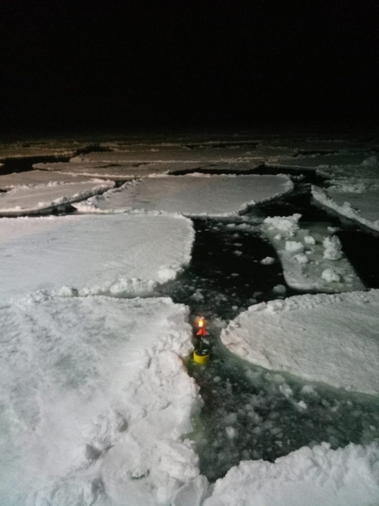
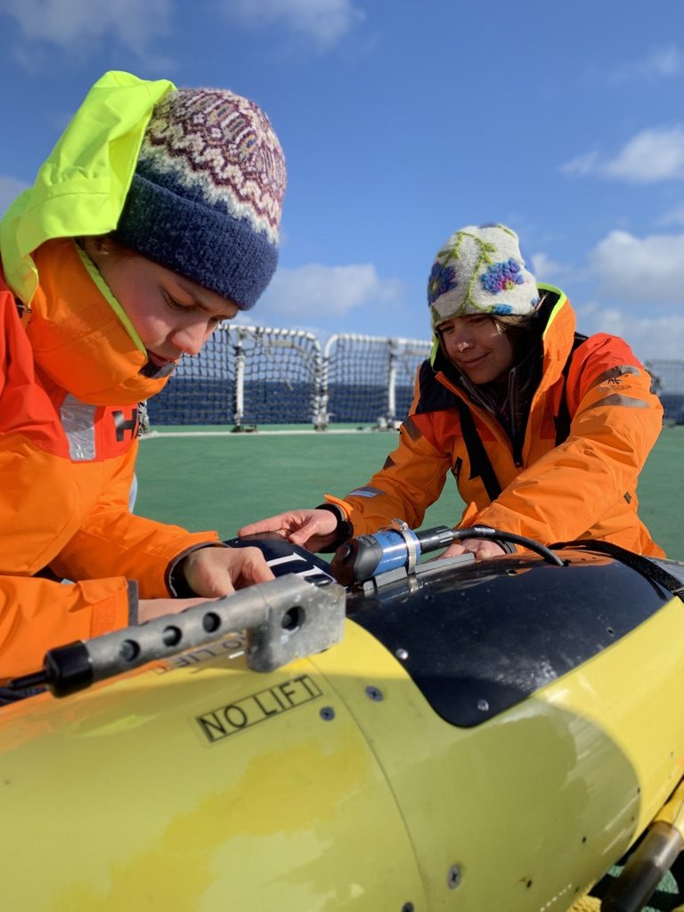
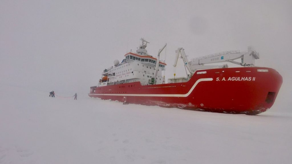
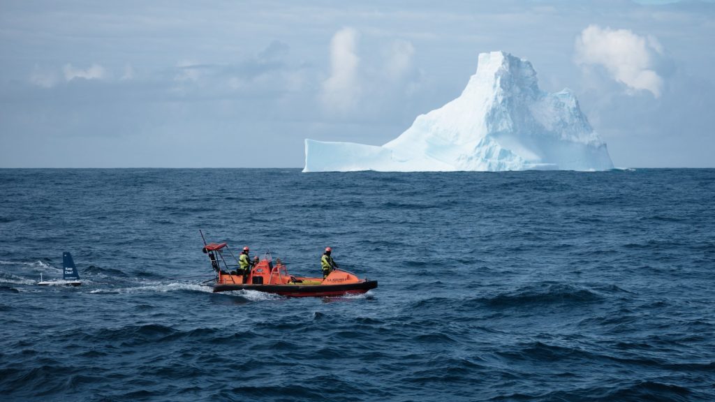
The ROAM-MIZ (Robotic Observations And Modelling in the Marginal Ice Zone) project aims to capture high resolution observations of how the upper ocean near and under sea ice responds to sea ice growth or melt. The team, led by SCOOT’s director Sebastiaan Swart at the University of Gothenburg, deployed multiple platforms in, and at the edge of, the marginal ice zone in austral winter and spring 2019. Using the South African icebreaker, the SA Agulhas II, as a deployment platform, three profiling ocean gliders (Seagliders), a surface glider (Offshore Sensing Sailbuoy), multiple wave-recording surface floats (SWIFT buoys) and two ice-moored buoys were deployed between 56-60°S. Between the 10 platforms, over 370 days of data were collected from this remote and under-sampled region of the Southern Ocean, with the longest continuous time-series of over 130 days.
The challenges that the deployment team and platforms faced included rapid freezing up of sensors in temperatures that dropped to minus 20°C (before wind chill), rough seas and rapid movement of sea ice floes. With support from collaborators around the world including CSIR (South Africa), CalTech (USA) and University of East Anglia (UK), this project has demonstrated that autonomous instrumentation holds the capability to explore and monitor some of the most inaccessible oceans on Earth. Data is now being processed by the team based at the University of Gothenburg, with the “live data” viewable on roammiz.com and the first paper recently published in Geophysical Research Letters. Projects update can be followed on @PolarGliders .
Project website: www.roammiz.com
Paper: Swart, S., du Plessis, M. D., Thompson, A. F., Biddle, L. C., Giddy, I., Linders, T., et al. ( 2020). Submesoscale fronts in the Antarctic marginal ice zone and their response to wind forcing. Geophysical Research Letters, 47, e2019GL086649. https://doi.org/10.1029/2019GL086649
Twitter: @PolarGliders

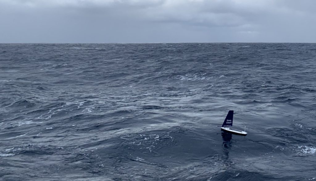


On March 1st University of Gothenburg’s surface glider SB Kringla was successfully retrieved to the South African icebreaker SA Agulhas II. For 78 days she has relentlessly battled the waves in the Marginal Ice Zone along the Greenwich meridian, see graph below. SB Kringla is the first Offshore Sensíng Sailbuoy to be deployed and retrieved on the southern hemisphere. She has measured ocean surface temperature and salinity, together with surface wind, temperature and pressure in the atmosphere. Data from SB Kringla as well as from diving Seagliders can be viewed at ROAM-MIZ. Do you have ideas about surface gliders or diving gliders? Contact us.

We are suspecting that SB Kringla has encountered an iceberg during the mission. It is likely this happened on February 7 when the weather station started to fail. On retrieval we could see that the sensor head of weather station was cracked and that there were substantial damage to the sail. Amazingly she had continued, with no apparent effect on sailing performance!


SCOOT director Sebastiaan Swart leads the major research project ROAM-MIZ, using sensors mounted on ocean robots/drones to investigate the marginal ice zone in the Southern Ocean. Information and near-real-time output from the sensors are available at the project website. The drones currently operating in the Southern Ocean include the diving (to 1000 m depth) Seaglider and the surface glider Sailbuoy, both available pro bono in the SCOOT offer to entrepreneurs, SMEs and researchers. Interested? Contact us!